I've been using an old cheap beaten up TomTom for years now. The reason being that it works and it plays well with the
Tyre route planning software. For pleasant and successful route planning Tyre has been much more important than the actual device mounted on the bike. So far there hasn't been an App available that would do what traditional GPS combined with Tyre have been able to do, that being easy route & waypoint planning and off line navigation.
My Requirements
When I'm planning a trip, what I want to do, is plan the route
exactly as I want. Not just "find scenic routes" not "avoid highways" etc. So far doing this with the actual navigator has been a nightmare. Phone apps have not been much better and very often there is a requirement for internet access.
Near constant mobile internet access on a proper road trip that usually takes me to other countries is either totally impossible / impractical or costs way too much.
My approach has been to use Tyre to plan my waypoints on the computer and then upload the finished route to the TomTom. No internet required on the road and the planning is a pleasure with a computer mouse and a big screen.
The current/previous way of planning a route and navigating on a motorcycle1. Plan the route with Tyre
2. Export the .ITN file to the TomTom navigator
3. load up the route from the TomTom menu
4. ride!
With the new
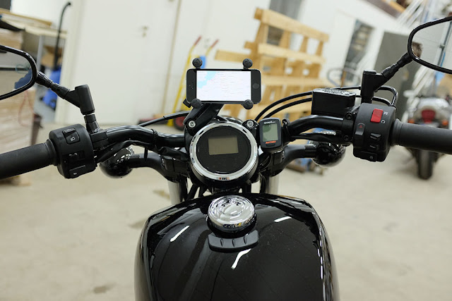
MotoEye App this is about to change. It looks like I can finally retire the TomTom and only have my phone with me for navigation. With this in mind I'm designing my "cockpit" so that I can easily see my phone and keep it charging while riding. The good thing is that I can still plan the route with the computer and everything works as before but I know have one less device to lug with me.
The future way of planning a route and navigating on a motorcycle?1. Plan the route with Tyre
2. Export the .GPX file to dropbox*
3. Load the .GPX file to the MotoEye App*
4. Ride
* For this to work you need a dropbox account and dropbox installed on your phone
I found out about the MotoEye a bit too late as the riding season is pretty much over. I'll have to wait for spring to test it properly, but so far it's looking promising.
For some reason most of the promising navigation apps designed for motorcyclist do not offer offline maps. That's pretty much a deal breaker for anyone planning to even a bit off the grid or go abroad where mobile data transfer charges can be obscene. MotoEye seems to be the only one that allows me to plan my routes on the computer and offers offline maps. If there are other options out there, please let me know!


